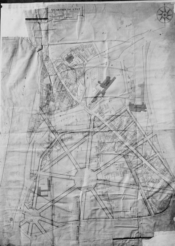
Plan cadastral de la ville de Liège : feuille 17 : quartier Est - 2ème feuille

 CC BY 4.0KIK-IRPA, Brussels (Belgium), cliché B162585
TitelPlan cadastral de la ville de Liège : feuille 17 : quartier Est - 2ème feuille
Objectnummer10127300
LocatieLuik[deelgemeente]
Objectnaam
Persistent identifier
hdl:20.500.14037/object.10127300Gekopieerd!
Productie en datering
Creator
Creation date
1810
Fysieke eigenschappen
Materialen
Technieken
Afmetingen
hoogte: 96 cm
breedte: 71 cm
Opschriften en merken
inscriptie
InhoudQuartier de l'Est : 2ème feuille
Methodeécrit
Notities
Feuille avec projet - non réalisé - d'urbanistaion
Rechten & gebruiksvoorwaarden
Metadata CC0
CC0Deze toewijzing aan het publiek domein geldt enkel voor de metadata. Geassocieerde foto's kunnen een eigen licentie of auteursrechtelijke status hebben.
Hoe te citeren
KIK-IRPA. (2001). Plan cadastral de la ville de Liège : feuille 17 : quartier Est - 2ème feuille [Object metadata]. https://hdl.handle.net/20.500.14037/object.10127300